


GeoWorld 2026 Brings 10,000+ Professionals to Dubai as Geospatial Technology Reshapes Cities and Infrastructure
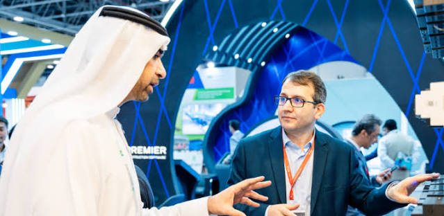
Surveyors, urban planners, infrastructure developers, government authorities, technology companies and geospatial specialists will gather at Dubai World Trade Centre from 23 to 26 November 2026 when GeoWorld returns with four days dedicated to the technologies changing how the physical world is measured, mapped and managed.
The event is expected to attract more than 10,000 professionals, over 50 global exhibitors, 20-plus industry speakers and participants from more than 110 countries.
Its exhibition, strategic content and live demonstrations cover technologies ranging from satellite imagery and geographic information systems to drones, artificial intelligence, digital twins, 3D mapping and advanced surveying equipment.
Geospatial technology rarely receives the public attention given to artificial intelligence or robotics.
Yet it quietly supports enormous parts of the modern economy.
Navigation depends on location data.
Cities use mapping to plan infrastructure.
Utility companies need accurate records of networks.
Construction companies survey sites.
Governments manage land.
Ports monitor assets.
Mining companies explore resources.
Emergency agencies assess disasters.
Modern economies increasingly need to know not simply what exists, but exactly where it exists and how it changes over time.
GeoWorld 2026 brings together the technologies behind that capability.
Geospatial Data Has Become Basic Infrastructure
Location information is no longer limited to conventional maps.
Modern geospatial platforms combine many data sources.
Satellite images.
Aerial photography.
Drones.
Laser scanning.
Surveying equipment.
Mobile sensors.
Building models.
Traffic information.
Environmental data.
These datasets can be layered together to create a far richer understanding of the physical environment.
For organisations working across construction, infrastructure and Dubai urban development, this information can influence decisions worth millions or even billions of dollars.
A small location error during planning can become an expensive problem during construction.
Better data reduces uncertainty.
Digital Twins Are Changing Infrastructure Management
Digital twins are one of the most important technologies within the modern geospatial sector.
A digital twin creates a digital representation of a physical asset or environment.
That asset might be a building.
A railway.
A port.
An airport.
A road network.
An entire district.
The digital version can be updated using real-world information.
Operators can monitor performance.
Engineers can test scenarios.
Maintenance teams can identify problems.
City authorities can understand how infrastructure interacts.
The value increases when the twin remains connected to current data rather than becoming only a static 3D model.
Cities Can Be Modelled Before Changes Are Made
Urban planners increasingly use three-dimensional city models to explore development scenarios.
What happens if a new tower is constructed?
How will shadows change?
How could traffic flows respond?
Which areas are vulnerable to flooding?
Where should utilities be expanded?
Could pedestrian connections improve?
Instead of relying only on drawings, planners can examine city systems spatially.
This makes geospatial technology an important tool for smart-city development.
AI Is Making Maps More Intelligent
Traditional mapping required significant human interpretation.
Artificial intelligence can accelerate parts of that work.
Satellite images can be analysed automatically.
Roads can be identified.
Buildings can be classified.
Changes between images can be detected.
Vegetation can be monitored.
Construction progress can be analysed.
AI can process quantities of imagery far beyond what individual analysts could examine manually.
Human verification remains important.
An algorithm can confuse objects or misinterpret unusual conditions.
But the combination of machine analysis and professional expertise can make geospatial work much faster.
Satellite Imagery Is Becoming More Accessible
Satellite data was once dominated by governments and very large organisations.
Commercial satellite companies have expanded access dramatically.
Images can now support agriculture, insurance, construction, environmental monitoring, defence, logistics and infrastructure.
Frequent imagery allows users to monitor change rather than relying on one-time snapshots.
A company can observe construction progress.
A government can examine land development.
Insurers can assess areas after natural disasters.
Farmers can monitor crop health.
The value increasingly comes from turning images into actionable information.
Drones Have Transformed Surveying
Drones allow organisations to capture detailed information from the air without using conventional aircraft.
A construction site can be mapped.
Stockpiles can be measured.
Road corridors can be inspected.
Infrastructure can be photographed.
Mining sites can be monitored.
Repeated drone flights make it possible to compare changes over time.
This is particularly useful for large projects where manual inspection is slow.
However, professional drone operations need appropriate regulation, trained operators and reliable data processing.
Flying the drone is only the first step.
The information it collects needs to be turned into something useful.
LiDAR Can Capture the World in Three Dimensions
Light Detection and Ranging, better known as LiDAR, uses laser pulses to measure distance.
Millions of measurements can create detailed three-dimensional point clouds.
LiDAR is used in surveying.
Autonomous vehicles.
Infrastructure inspection.
Forestry.
Architecture.
Archaeology.
City modelling.
The technology can capture geometry with extraordinary accuracy.
Mobile LiDAR systems can scan streets while vehicles move.
Airborne systems can cover large areas.
The resulting data becomes a foundation for modelling and analysis.
Surveying Is Becoming More Digital
Professional surveyors remain fundamental to construction and land management.
Their tools are changing.
Total stations connect with digital systems.
GNSS receivers provide precise positioning.
Laser scanners capture complex environments.
Cloud platforms allow teams to share results.
Automated processing reduces repetitive work.
The surveyor increasingly operates as a data professional as well as a measurement specialist.
This raises demand for new technical skills.
BIM and Geospatial Data Are Moving Closer Together
Building Information Modelling focuses heavily on individual buildings and infrastructure assets.
Geographic Information Systems traditionally operate at larger geographic scales.
Connecting the two creates significant opportunities.
A detailed building model can be understood within its wider city.
Utilities can be coordinated.
Road networks can be analysed.
Development planning improves.
Asset owners gain a clearer picture of how their properties interact with surrounding infrastructure.
The boundaries between architecture, engineering and geospatial technology are becoming less rigid.
Construction Companies Can Monitor Progress More Accurately
Large construction projects involve thousands of activities.
Geospatial technologies can compare actual site conditions against planned models.
Drone imagery provides regular updates.
Laser scanning can capture completed work.
Digital platforms can highlight discrepancies.
This helps teams identify problems earlier.
Correcting an error before the next construction stage is usually much cheaper than discovering it months later.
Data becomes a quality-control tool.
Utilities Depend on Accurate Location Data
Water pipes.
Electricity cables.
Telecommunications.
Gas networks.
District cooling.
Much of a city’s essential infrastructure is hidden underground or inside buildings.
Poor records create serious risk.
Construction crews can damage utilities.
Maintenance becomes slower.
Planning becomes harder.
Modern asset-management systems use geospatial information to create accurate digital records.
Cities become easier to operate when infrastructure is visible digitally even when it cannot be seen physically.
Geospatial Intelligence Supports Disaster Response
Floods, fires, earthquakes and other disasters create rapidly changing environments.
Emergency agencies need situational awareness.
Satellite images can show affected areas.
Drones can inspect locations too dangerous to enter immediately.
Mapping systems identify roads that remain accessible.
Population data helps prioritise response.
The faster reliable information becomes available, the better emergency decisions can be.
Geospatial technology therefore has a direct public-safety role.
Climate Risk Is Increasing Demand for Mapping
Cities increasingly need to understand environmental risk.
Which neighbourhoods face flood exposure?
Where are temperatures highest?
How is coastline changing?
Which infrastructure is vulnerable?
Spatial analysis helps answer these questions.
Climate adaptation requires knowing where risks are concentrated.
A general climate forecast provides useful context.
A city needs much more detailed information before deciding where to invest.
Urban Heat Can Be Mapped
Heat does not affect every part of a city equally.
Dense construction, limited vegetation and dark surfaces can create urban heat islands.
Satellite and sensor data can help identify hotter zones.
Authorities can then consider trees, shading, reflective materials or different urban design strategies.
The technology connects environmental science with practical city planning.
Precision Agriculture Depends on Location
Agriculture is another major geospatial application.
Satellite imagery can identify crop variation.
GPS-guided equipment can apply inputs precisely.
Drones monitor fields.
Farmers can map irrigation.
Different areas of one farm may need different treatment.
Using the same amount of water, fertiliser or pesticide everywhere can waste resources.
Precision agriculture uses spatial information to target interventions.
Mining Relies on Accurate Geospatial Information
Exploration and extraction are deeply geographic.
Geologists map formations.
Surveyors monitor pits.
Drones measure stockpiles.
Satellite data supports regional exploration.
Autonomous mining equipment requires accurate positioning.
Environmental impacts also need monitoring.
GeoWorld’s overlap with infrastructure, mining and industrial development makes Dubai a natural meeting point for these technologies.
Ports and Maritime Operators Use Spatial Intelligence
Ports are complex environments.
Ships move.
Containers move.
Vehicles move.
Cranes operate.
Storage areas change constantly.
Digital mapping can improve planning.
Drones inspect infrastructure.
Satellite data supports maritime awareness.
Positioning systems help automate equipment.
As ports become more connected, spatial information becomes part of daily operations.
Autonomous Vehicles Need Extremely Accurate Maps
Self-driving systems rely on sensors mounted on vehicles.
They also benefit from detailed location information.
Road geometry.
Lane markings.
Intersections.
Traffic infrastructure.
High-definition maps can provide contextual information beyond what a vehicle sees at one moment.
Keeping these maps current is challenging because roads change.
Construction happens.
Lane layouts are modified.
The map increasingly becomes a dynamic data product rather than a static document.
Indoor Mapping Is a Growing Opportunity
GPS works well outdoors but can be unreliable inside large buildings.
Yet airports, hospitals, shopping malls and warehouses need indoor location services.
Mapping interiors enables navigation.
Asset tracking.
Emergency response.
Facility management.
Retail analytics.
Large venues can become almost like miniature cities.
Indoor spatial data is therefore becoming an important part of the geospatial industry.
Digital Ownership of Spatial Data Matters
As more systems collect location information, organisations need clear data governance.
Who owns the survey?
Who can update it?
Which dataset is authoritative?
How often is information refreshed?
Can contractors access sensitive infrastructure maps?
Poor governance can create several versions of reality.
Good geospatial systems need both accurate data and clear responsibility for maintaining it.
Cybersecurity Is Important for Mapping Systems
Some geospatial information is sensitive.
Utility layouts.
Critical infrastructure.
Government facilities.
Transport systems.
Defence locations.
Unauthorised access could create security problems.
Organisations need to balance collaboration with protection.
Cloud-based geospatial platforms make sharing easier, but permissions need careful design.
Spatial data should be treated as an important information asset.
GeoWorld Brings the Physical and Digital Worlds Together
Many technologies discussed at modern technology conferences exist primarily in software.
Geospatial technology connects software directly with physical reality.
Coordinates represent actual places.
Digital twins represent actual assets.
Drone images show actual construction.
Satellite data measures actual environmental change.
This gives the industry a practical character.
Accuracy matters because decisions eventually affect real roads, buildings and infrastructure.
10,000+ Professionals Create a Cross-Industry Marketplace
GeoWorld expects more than 10,000 global attendees, over 50 exhibitors and participants from more than 110 countries.
The audience extends beyond surveyors.
Governments.
Municipalities.
Infrastructure developers.
Energy companies.
Defence organisations.
Ports.
Transport companies.
Agriculture.
Mining.
Financial services.
Disaster-management authorities.
All depend on geographic information in different ways.
This cross-industry reach is what makes geospatial technology increasingly important.
Four Days Focused on Understanding the World More Precisely
Every infrastructure decision happens somewhere.
Every building occupies land.
Every utility follows a route.
Every city grows spatially.
Every disaster affects a location.
GeoWorld 2026 is built around the technologies that help organisations understand those relationships.
From 23 to 26 November, Dubai World Trade Centre will bring together the companies and professionals turning the physical world into usable digital information.
Satellite imagery.
AI.
Drones.
Digital twins.
3D mapping.
Surveying.
Spatial analytics.
Different technologies serving one underlying goal:
making better decisions by understanding exactly where things are, how they interact and how they are changing.